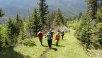
This hike was a long one. We departed the City of Calgary at about 8:00 in the morning. Grab a coffee for the drive up because it's a great way to start off a quiet morning. A nicely paced out morning cup of java will slowly dissolve the stresses that scratch at us everyday while living the city life. Calgarians and town-folk living in the Great Plains Region are bonused with thousands of quare kilometers, and a handful of entrances that lead us unto the place on earth we call "God's Country." There are good reason why tens of thousands of travellers venture here on a yearly basis. A great place with many areas to stop and smell the roses...and the occassional wild animal pile of doo doo. Anyways...back to the drive. As I degress from deep thought....this place does it to me all the time.
Back to the story....I love this drive. About 40 minutes west of the city, there's a section of the hiway that opens up into a large scenic vastess of Beauty. And this section of Canada's #1 hiway, is the road where I'm driving in my dreamcar. I'll throw in some Sarah McLaughlin, or maybe for a little pep in my step, some Sammy Hagar while cresting placeholder hill in my GT-40. Here is where I'll slip into the notion of "take me now!" on a drive over the doorsteps of the Eastern Slopes at the Rocky Mountains. That coffee should be getting close to the bottom. And with that, you'll be arriving at the WIND VALLEY DAY USE AREA in the town of Canal Flats. The parking lot has ample parking and serviced washrooms.
 This hike takes approximately eight to ten hours to complete round trip. Pack yourself at least 4 litres of water and an ample lunch. You will ascend this ridge at a continuous rate which will burn through your calories quickly. As you're ascending up the trail, look for a trail marker on your left hand side approximately 2 Km from the trailhead. Here you can either stay the course or hike up this pathway to meet back up again with the main trail. The lower section of the trail has always been a bit challenging I am told. Wind Ridge is criss-crossed with old coal mine exploration roads where one can easily get lost in. Add to that, recent damage from flooding has obliterated or blocked some of the trail, requiring some off trail bushwhacking through dense forests. This hike takes approximately eight to ten hours to complete round trip. Pack yourself at least 4 litres of water and an ample lunch. You will ascend this ridge at a continuous rate which will burn through your calories quickly. As you're ascending up the trail, look for a trail marker on your left hand side approximately 2 Km from the trailhead. Here you can either stay the course or hike up this pathway to meet back up again with the main trail. The lower section of the trail has always been a bit challenging I am told. Wind Ridge is criss-crossed with old coal mine exploration roads where one can easily get lost in. Add to that, recent damage from flooding has obliterated or blocked some of the trail, requiring some off trail bushwhacking through dense forests.
 Along the way are numerous types of plant life and flowers. Truly informative and will open your eyes to the wonders at your feet that you would otherwise just walk by and never give Along the way are numerous types of plant life and flowers. Truly informative and will open your eyes to the wonders at your feet that you would otherwise just walk by and never give
a second glance. An experience that is so much more than just looking at the wonderful vistas.
Wind Ridge is a 7,217 ft / 2,200 m mountain peak near Canmore, Alberta, Canada. Based on peakery data, it ranks as the 961st highest mountain in Alberta and the 3055th highest mountain in Canada. The nearest peaks are Middle Sister (Charity Peak), Rimwall, Little Sister (Hope Peak), Windtower, Big Sister (Faith Peak), and Mount Lougheed North.
  |

